I'm kinda curious about this Japan-thing and so I made some calculations (and searched old school files):
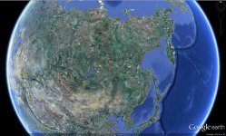
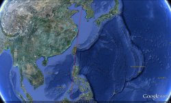
From the latitude of the pad and the inclination of 98° I end up with the two possible azimuths of -10.42° over China and Russia and the probable azimuth of 190,42° over the Yellow Sea.
This then looks quite different to the map by Bob Christy, posted by Galactic Penguin, so I'm not sure who made a mistake.:hmm:
So, the facts to Japan:
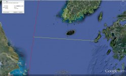
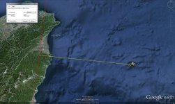
The nearest point to the "mainland" is somewhere in the Yellow Sea, 500 kilometers distance.
The nearest point to Japanese territory should be to Yonaguni, 125 kilometers, BUT downrange of 1,700 kilometers to to launch pad (comparable to CapeC and Bermuda).
The attached files are 4 screenshots from Google Earth, first two show the possible trajectories (I've rescaled them a bit because someone is not able to keep file sizes in their restriction:shifty
")
, next two show the distances from Japan to the southern trajectory. GE interface is in german, but the first number is the right one:thumbup: