Orbiter Screenshot Thread

Working on the entire Gemini 11 flight. Up to Gordon's spacewalk now:

North Africa on REV 14 a couple orbits from the EVA:


Hatch opening:


Over Baja:


Cabin:


Going for a walk:


A few more holiday snaps from my tour through the experimental high resolution map. Today: the Canary Islands

La Palma:
picture.php


Tenerife:
picture.php


Gran Canaria:
picture.php
 
I think I'm going to cry. :bighug:
 
I just have to wonder - are those shadows baked into the texture?

Partly. The textures are essentially straight Landsat images, so they inherently contain shadows. There are ways to process these shadows away - the meta data include sun azimuth in addition to elevation, so together with the elevation data it should be possible to un-shadow the images. But I haven't tried any of this, and I don't really think it's worth it. For most of the day the shadows are reasonably consistent, they provide a (fake) illusion of higher elevation sampling resolution than there really is, and they compensate a bit for the lack of self-shadowing in the graphics engine.
 
Which HST is that, and where do I get the reflections? I'm testing SSU right now with my own fictional deployment mission and this would be a nice addition.

Reflections I did myself, using material editor in debugger D3D9. Used HST version is here: [ame="http://www.orbithangar.com/searchid.php?ID=5484"]HST-Ex[/ame]

---------- Post added at 19:51 ---------- Previous post was at 18:22 ----------

Woah, is that post-production or a graphics client?

Can't wait for that height map stuff... :cheers:

Postroduction? It's only D3D9 Graphic Client. ;)

---------- Post added at 20:30 ---------- Previous post was at 19:51 ----------

This time, AMSO:
%255BGroup+1%255D-orbiter+2013-12-04+22-02-55-89_orbiter+2013-12-04+22-04-16-36-70+images.jpg

%255BGroup+3%255D-orbiter+2013-12-04+22-16-56-23_orbiter+2013-12-04+22-19-30-46-103+images.jpg

%255BGroup+5%255D-orbiter+2013-12-04+22-34-45-16_orbiter+2013-12-04+22-35-57-90-41+images.jpg

%255BGroup+6%255D-orbiter+2013-12-04+22-37-40-89_orbiter+2013-12-04+22-38-55-58-52+images.jpg

This photo, unfortunately with defect.
%255BGroup+8%255D-orbiter+2013-12-04+22-46-40-35_orbiter+2013-12-04+22-47-22-17-19+images.jpg

%5BGroup+3%5D-orbiter+2013-12-05+16-50-25-41_orbiter+2013-12-05+16-51-06-90-46+images.jpg

%255BGroup+4%255D-orbiter+2013-12-05+16-55-16-40_orbiter+2013-12-05+16-56-04-14-51+images.jpg

%255BGroup+5%255D-orbiter+2013-12-05+16-59-42-10_orbiter+2013-12-05+17-00-07-02-24+images.jpg

%255BGroup+7%255D-orbiter+2013-12-05+17-07-12-90_orbiter+2013-12-05+17-08-47-18-93+images.jpg


Higher resolution and other screens available on my Google+ Gallery:
https://plus.google.com/photos/1019...s/5952521976456929345?authkey=CL7shdS9jtWs4wE
 
A few more holiday snaps from my tour through the experimental high resolution map. Today: the Canary Islands

Looks very good. :tiphat:
Nice detail indeed, in my opinion the terrain details is perfect for a global mesh. If we add local high resolution textures with normalmaps it will look good as it is even if seen much closer.
 
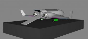
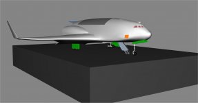
Progress on the Jason ll.
 

Attachments

  • Jasonll.jpg
    Jasonll.jpg
    45.6 KB · Views: 93
  • Jasonll2.jpg
    Jasonll2.jpg
    51.7 KB · Views: 81
Slowly progressing

starchaser3-angles.jpg


starchaser3.jpg
 
Back
Top