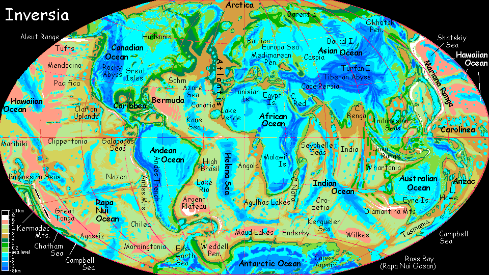
This is a poor map of what Earth would look like if the topography were inverted. For starters, the 'mountains' and soforth on the 'former' seafloors do not correlate to actual bathymetry whatsoever. The maps made by the author of Planetocopia are far better in this regard. Here's Earth with inverted topography and enough water added to roughly maintain the old coastlines;
The first thing one notices is that water has also collected in the depressions that 'used to be' mid-ocean ridges, seamounts, other examples of submarine topography, etc. There's nothing special about the 'continental' depressions- disregarding rates of evaporation/precipitation, water will collect at any low point.
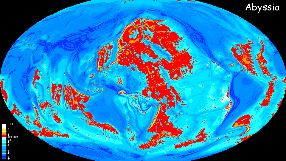
The amount of water needed to 'fill up' the inverted continents is arbitrary and much less than Earth's total water. If one inverts Earth's topography but maintains the same amount of water, one gets something more like this;
Which demonstrates just how platform-like the continental plateaus
are.
Quite a bit of the artwork on the site of which Planetocopia is a part is quite odd and not work-safe, but the planetocopia maps and globes themselves are quite impressive and I can't think of anything of their sort elsewhere on the internet. They've also created renditions of Earth with poles in different locations, as well as fictional planets, a deglaciated Earth, and a terraformed Mars and Venus.