Apollo-8 Tutorial Info Needed

polaris149Tiberius

Tutorial Publisher
Tutorial Publisher
Joined
Apr 12, 2008
Messages
192
Reaction score
2
Points
0
Website
www.101stAirborneDivisionClan.com
Apollo-8 Tutorial Info Needed

Hello all physics people,
I am going to begin a tutorial for Apollo-8 that I want to be realistic. I have a bit of a question though. Hopefully someone here knows the answer.
Apon starting the AMSO 1.17 Apollo-8 flight in Orbiter 2006 P1, and the plane of the moon on the desired Launch time of 12:51:00 shows in Orbiter default MapMFD shows the moon in a very off-plane position.
Here is what it shows:


I fast forward a few hours and the moon's orbital plane begins to approach the Cape for a much better launch azimuth.
Does anyone know if this is the plane where the moon was located when the real Apollo-8 was ready to launch because if launching at this time (AMSO's recommended time of 12:50:00 not the historical 12:51:00) was when NASA launched, then all they had to do was wait a few hours and the plane of the moon would be in a much better launch azimuth to match at launch.
My question is three fold:
#1 does anyone know if this is where the Moon's plane was at this time of launch or is this just where Orbiter has put the moon's plane at this time in history?
#2 Is orbiter precise enough to have the moon in the correct location and orbital plane to coencide with real life?
#3 If orbiter is showing the moon in the correct location and orbital plane as Orbiter is showing in this picture, why would NASA launch at this very offplane launch time?
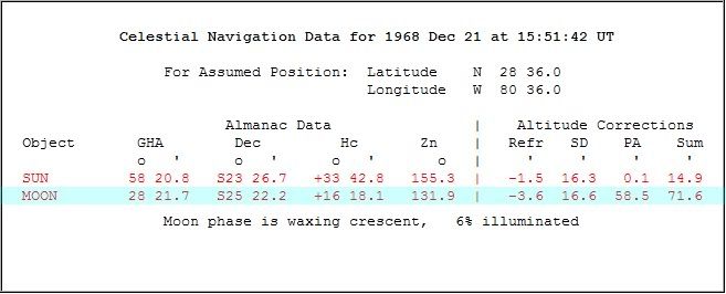
Note: Even launching at the more historical time of 15:51:00 has a very much off plane type launch.
Thanks in advance for any help anyone can offer to this question.
 
Last edited:

NukeET

Gen 1:1
Addon Developer
Donator
Joined
Oct 16, 2007
Messages
1,035
Reaction score
93
Points
63
Location
UT_SLC
Website
sites.google.com
All good questions...unfortunately I don't have an answer.

If you think Apollo 8 was bad...look at Apollo 12.
 

polaris149Tiberius

Tutorial Publisher
Tutorial Publisher
Joined
Apr 12, 2008
Messages
192
Reaction score
2
Points
0
Website
www.101stAirborneDivisionClan.com
Ok I will check it out BUT...

Ok I will check it out BUT...

If you think Apollo 8 was bad...look at Apollo 12.

Ya this seems to be a question that we may need to address to NASA. I will look into the channels that are needed to ask this question of NASA. I will look at the Official Apollo 8 Page from NASA to see if there is any information listed there about the position of the Moon at this time.

Unless somone else here has the answer. I will let this thread ride for a couple of days to see if anyone else has the answer.

Just for the record, it IS possible to complete the mission goals Apollo 8 has with the exsisting fuel in both vehicles (Saturn V, stage 3, and the Apollo 8 Service Module) to get to the moon using IMFD v5.1h's Off-Axis transfer program to get to the moon and complete the 20 orbits the real Apollo 8 mission did, AND still have enough fuel to get home and re-entry in the pacific.

I just wondered if Orbiter can offer a better model for where the moon is supposed to be at this date: December 21 at UT 12:51:00. If its correct, then GREAT!! If its not then maybe somone (or myself) can work on a better scenario for ArcSoft's AMSO scenario for Apollo 8.

Im sure that the goal of this scenario is to best emulate the condition of the solar system at the correct flight date.


Ok I have some good information but I dont really understand it all. Maybe somone here can decifer what this all means:
(taken from NASA's Launch/Orbital information for Apollo 8 page):
Apollo 8
Launch Information
Launch Date: 1968-12-21 at 12:51:00 UTC
Launch Vehicle: Saturn 5
Launch Site: Cape Canaveral, United States

Trajectory Description
No description available.

Trajectory Details
Type: Orbiter
Central Body: Earth
Epoch start: 1968-12-21 05:06:00 UTC
Epoch stop: 1968-12-21 15:41:37 UTC
Orbital Parameters
Periapsis 183.2 km
Apoapsis 190.6 km
Period 88.15 minutes
Inclination 32.51°
Eccentricity 0.00113


Now I understand the Orbital parameters ACCEPT the Inclination. This may be very very basic, but I have noticed that my Inclination changes as I orbit the body (earth)while looking in Align Plane MFD AND its at 51.65*
and my reported LAN is 154.78* instead of the 32.51* listed above.
#1 Why do I have this discrepency in Inclinations using Align Plane MFD?

Also, if I look in Orbit MFD my Inc is 31.62* and a LAN of 140.40*.
#2 Why is there a difference in the two Inclinations and LANs between the two default MFDs in Orbiter?

#3 Which one do I pay attention to as the correct Inc and LAN?

Now these questions Im sure have allready been addressed, so maybe somone could direct me to the correct thread or even better, somone could re-answer the questions here and get a second chance to answer the questions in a more precise and layman's term type of answer for us newbies.

In the mean time I will research who to contact at NASA to find out where the moon was and its plane was at this date.
Ok I will be contacting Dr. David R. Williams via email to see if I can get a responce to this question.

Thanks to all who responded.
 
Last edited:

polaris149Tiberius

Tutorial Publisher
Tutorial Publisher
Joined
Apr 12, 2008
Messages
192
Reaction score
2
Points
0
Website
www.101stAirborneDivisionClan.com
My Email to Dr. Williams

My Email to Dr. Williams

Guys and gals of the Orbiter Forums, I have just emailed Dr. Williams to see if he can shed some light on where the moon was at Apollo 8's launch time of UTC Saturday Dec 21, 12:51:00 1968.

Here is the email in it's entirety:


"
Dear Dr. Williams,

I am a proud student of a very nice realistic space simulator known as Orbiter 2006 written by Dr. Martin Schweiger at the University College London DEPARTMENT OF MEDICAL PHYSICS AND BIOENGINEERING. His Orbiter Space Flight Simulator has ecome very popular as it is mostly open source and allows for addons and external objects to be added as additions to the simulator.

Can be found and downloaded for free here: http://orbit.medphys.ucl.ac.uk/

One such add-on is the very popular AMSO version 1.17 from some programmers at ArcSoft found here: http://www.acsoft.ch/AMSO/amso.html

To get right down to the point at hand, I am a tutorial developer that writes technical documents for beginners to Orbiter and AMSO that allows for them to emulate the Apollo Program's flights in a historical manor.
At a very popular Orbiter Space Flight Simulator's forum, I have posted a question to the physics section of the forums that deals with the accuracy of Orbiter when it comes to the exact location of the moon and its orbital plane with respect to the Earth during Apollo 8's launch time which as we all know is UTC Saturday Dec 21st at 12:51:00 1968.

The question is as follows: Is the orbital plane and the location of the Moon accurate to where the scenario that our simulator (Orbiter) shows in the picture shown in the forums thread listed here: http://orbiter-forum.com/showthread.php?p=27001#post27001?

Could you please have a look at the picture listed in that thread and let me know if the moon is in the correct location and orbital plane as shown in the photograph of the earth map. (http://img120.imageshack.us/my.php?image=apollo8map0010hh2.jpg)

We at Orbiter-Forums would be eternally thankfull if you could explain where the moon was located at the time of launch because we have some suspisions that NASA would rather launch at a time when the Lunar orbital plane is closer to a crossing point over the Cape. In other words it would be much cheaper to launch a few hours later according to the Moon's position in this image when the lunar orbital plane is about to cross over the Cape's location on the surface of the earth because Apollo 8 would save on propellant during its TLI burn if it were closer to being in plane with the moon.
Does this make sence? Sorry if I am not good at explaining what I am asking and I welcome any correspondance you may have to clear up my question. If you could just take a moment of your busy schedule to address this question, we at Orbiter-Forums would be eternally gratefull.

Thank you to the power of 100 (Thank You ^100),
Adam Rodriguez
Orbiter Space Flight Simulator 2006 P1 Tutorial Technical Writer"


I hope to recieve a responce regarding this issue as soon as possible.
 

pattersoncr

Tutorial Publisher
Tutorial Publisher
Joined
Oct 17, 2007
Messages
417
Reaction score
3
Points
0
Location
Eastern PA
Ok I will check it out BUT...
#1 Why do I have this discrepency in Inclinations using Align Plane MFD?

Also, if I look in Orbit MFD my Inc is 31.62* and a LAN of 140.40*.
#2 Why is there a difference in the two Inclinations and LANs between the two default MFDs in Orbiter?

#3 Which one do I pay attention to as the correct Inc and LAN?

There are two ways to measure the inclination of an orbit:
- Inclination relative to Earth's equator (equatorial inclination)
and
- Inclination relative to the eclliptic (the plane of the Earth's orbit). This is called eclliptial inclination

Align Planes MFD alwas shows ecllicital inclination.
Orbit MFD can display either one. Click on [FRM] to switch.

Hope that gets you started.
 

glsimpilot

New member
Joined
Jun 27, 2008
Messages
1
Reaction score
0
Points
0
Fantastic, I would be extremely interested to read a response posted here. Thread subscribed.
 

Mafuskas

Donator
Donator
Joined
Jan 5, 2008
Messages
81
Reaction score
0
Points
6
Location
South Bend, IN, U.S.
Funny you should bring this up now, as I was considering the same situation myself.

I'm not sure if you've encountered this web application in your search for information regarding this topic or not, but if you haven't, perhaps the data it provides will help in some way.

http://aa.usno.navy.mil/data/docs/celnavtable.php

A table of data will be provided giving both almanac data and altitude corrections for each celestial body that is above the horizon at the place and time that you specify. Sea-level observations are assumed. The almanac data consist of Greenwich hour angle (GHA), declination (Dec), computed altitude (Hc), and computed azimuth (Zn). The altitude corrections consist of atmospheric refraction (Refr), semidiameter (SD), parallax in altitude (PA), and the sum Refr + SD + PA. The SD and PA values are, of course, non-zero only for solar system objects.

Entering the location of LC 39A and the time of Apolo 8's liftoff gave me a table of data. I have edited it to condense it down to just what is really relevant to us, but if you want the whole thing, just enter the numbers I did.

moondatacrop.jpg


I'm not sure if these numbers help any for this topic, let me know what you find.
 

polaris149Tiberius

Tutorial Publisher
Tutorial Publisher
Joined
Apr 12, 2008
Messages
192
Reaction score
2
Points
0
Website
www.101stAirborneDivisionClan.com
Im thinking yes

Im thinking yes

This is fantastic! Thanks for this info. Could you possibly post this information as text rather than an image? I would be gratefull. It is helpfull for knowing where the moon was in relation to the ground position of the cape, but I am not aware of how to turn that into information into something we can add into Orbiter's Map Program and show the location of the moon and its orbital plane. This the specific information we need. BUT having said that, thank you for your help, and this information may be what we want just not in the format we need it.

This information can be very helpfull if somone can do the triginomic calcuations to place the moon on this map program. This might be a good start for us to start at for this information:
Lunar distance (navigation) Wiki
Anyone know how to change the surface visible Inclination and declination to equal a position on the earth's surface on a flat map?


I have found an interesting lead in google earth that this page sites locating the moons position on google earths surface but its for a more recent timeline. Does anyone here know how to change the time in google earth to show a similar timeline but in 1968. Check this page out:

This may be what were looking for if its accurate: Lunar Position and Phase in Google Earth

Also, after continuing my research of Apollo 8 Launch Window, I have been reading The Apollo 8 Flight Journal this page and found this passage:

[Launch is scheduled to happen at 07:51 on December 21 but it can be delayed somewhat, providing certain variable factors remain within limits. First, they want to be at the Moon when the lighting at Mare Tranquillitatis is at a low angle from the east. The possible landing sites are in this area and part of the mission's brief is to comment upon lighting conditions. There are only a few days each month when this is suitable. Also, they wish to launch in daylight, then have the spacecraft over a particular part of the Earth when they boost to the Moon. This further constrains the launch window to a few hours each day. Today's launch window opens 38 seconds before the planned launch and lasts 4 hours, 39 minutes.] 1

And...

[The guidance and control of the Saturn V is achieved independently from the spacecraft by the Instrument Unit (IU) a one-meter ring atop the S-IVB stage. This contains its own computer, the LVDC (Launch Vehicle Digital Computer), and a gyroscopically stabilised platform, the ST-124. The platform is aligned prior to launch by rotating its X stable member with respect to a theodolite, located some distance down the crawlerway. A small window in the side of the IU allows the theodolite to view the platform. For this launch, the precise azimuth will be 72.124°.] 1

and this...

[Both of the launch pads at Complex 39, Kennedy Space Center, and the crawlerways that approach them, are aligned with true north. The main hatch of the spacecraft is facing due east and if the whole vehicle were to lift-off, pitch over and fly to the east, its flight azimuth would be 90°. However, the desired azimuth is 72° so after lift-off the vehicle will roll 18° to face the main hatch slightly north of east. It will then pitch over and fly along a bearing of 72°.] 1

...and later on this passage:

[Clear of all the pad's ironwork, the rocket can safely rotate around its longitudinal axis by 17.876° from its launch roll angle of 90 ° to its flight azimuth of 72.124°. With the roll completed, it will begin pitching over to fly along this bearing with the crew in a heads-down attitude. All these maneuvers are pre-programmed - although the rocket's computer 'knows' where it is, it is not using that information to adjust its flight path. It will dumbly fly a precise set of maneuvers, known as the tilt sequence, until the second stage has taken over. This sequence has been computed to place as little sideways aerodynamic force on the vehicle as possible while it gets through the thicker atmosphere.]
000:00:18 Borman: How do you hear me, Houston? 1

I think this is very helpfull information and I will continue to research this question for mysel and for this community.
Thanks in advance.

1 Special thanks to NASA for this information from the The Apollo 8 Flight Journal
 
Last edited:

Mafuskas

Donator
Donator
Joined
Jan 5, 2008
Messages
81
Reaction score
0
Points
6
Location
South Bend, IN, U.S.
Could you possibly post this information as text rather than an image?

Certainly, and if you need the table straight from the source, its quite simple to enter the data into the web app itself (link in my last post).

Code:
            Celestial Navigation Data for 1968 Dec 21 at 15:51:42 UT           
                                                                               
                 For Assumed Position:  Latitude    N  28 30.0                 
                                        Longitude   W  80 36.0                 
                                                                               
                        Almanac Data                |    Altitude Corrections  
 Object       GHA        Dec         Hc       Zn    |   Refr   SD    PA    Sum 
              o   '      o   '      o   '       o   |     '     '     '     '  
 SUN         58 20.8   S23 26.7   +33 48.3   155.3  |   -1.5  16.3   0.1  14.9 
 MOON        28 21.7   S25 22.2   +16 22.1   131.9  |   -3.6  16.6  58.5  71.6


I'm glad to see that this is potentially useful. I'm sure I might be able to figure it all out and come up with what we are looking for if I were to put my mind to it, but right now I'm just being lazy about it. I was kinda just thinking of using that last bit in the table and then looking at the moon from Earth in Orbiter and seeing if it looks about 6% lit...though that is not exactly a technical way of going about it. ;)
 

polaris149Tiberius

Tutorial Publisher
Tutorial Publisher
Joined
Apr 12, 2008
Messages
192
Reaction score
2
Points
0
Website
www.101stAirborneDivisionClan.com
Odessey, Houston -You are go for orbit.

Odessey, Houston -You are go for orbit.

Thanks, I think that the information from the The Apollo 8 Flight Journal has given us a clue to the answer. The areas that I highlighted seem to point to the fact that NASA didnt care so much about launching at the most cost effecient time with respect to the moons alignment with Cape Canaveral (Cape Kennedy at the time of Apollo 8). Several things tell me this.
1. They are more worried about a window that allows for arrival because "they want to be at the Moon when the lighting at Mare Tranquillitatis is at a low angle from the east."

2. They used an azimuth of 72.124* ("the precise azimuth will be 72.124°") and this would only happen if the moon was offset from orbital alignment with the Cape. If the moon's orbital plane is perfectly across the Cape at the time of launch, the azimuth is 90*. I tested this out launching at a more perfect alignment as in this picture:


The launch azimuth was 90* or due east and this saved fuel but not much. So this tells me they didnt launch at this window but at a window that caused them to launch at an azimuth of 72.124*. So the 90* window is out.

3.They are also worried about launching at daytime as it says in this passage:
"There are only a few days each month when this is suitable.Also, they wish to launch in daylight, then have the spacecraft over a particular part of the Earth when they boost to the Moon".
The window above was a night launch.

This still does not answer the original question of where was the orbital plane at the time of the historical launch and where was the moon at this time as well as seen in map MFD. But it tells me that it didnt happen at the most optimum launch azimuth.

Still looking for the original information. That google map thing looks helpfull if I can get the timeline down to 1968. Dont know how to do that.

On a side note Im still waiting on the reply back from Dr. David R. Williams of NASA's Apollo 8 official webpage. Im sure he has a bit of a back log of emails from the public at large. Ill give it a few more weeks. But it will be nice to be in touch with somone from NASA for once. I like those guys. They kick ass.
 

polaris149Tiberius

Tutorial Publisher
Tutorial Publisher
Joined
Apr 12, 2008
Messages
192
Reaction score
2
Points
0
Website
www.101stAirborneDivisionClan.com
Thanks Chuck

Thank Chuck,


There are two ways to measure the inclination of an orbit:
- Inclination relative to Earth's equator (equatorial inclination)
and
- Inclination relative to the eclliptic (the plane of the Earth's orbit). This is called eclliptial inclination

Align Planes MFD alwas shows ecllicital inclination.
Orbit MFD can display either one. Click on [FRM] to switch.

Hope that gets you started.

This does get me started. With your permission I have added your help into my tutorial word for word and given thanks to you in the special thanks area of it as well. I hope this is alright. Check it out so far:
"When We Left The Earth" Episode 6 a Default Space Shuttle STS to ISS Tutorial which is a different tutorial I am working on as well.


...and thanks again for that info.
 
Top