Wedge313
Well-known member
Did you do a AOT star check with P52
Yes, and that wasn't centered. It was right on the Y axis but a bit above the X axis, not too far off but not centered.
Last edited:
Did you do a AOT star check with P52
You mean when doing the LR test? If so I think our test signals are hardcoded, I don't know if the ones for the J missions are implemented they might be driving to a signal expected from an earlier mission.Question: my landing radar check is off, my tape meter reads 8290 and rate -494, both out of tolerance (8000 +/- 100, -480 +/- 2). But the N65 values were all good. Anything I can do here?
Looks like you beat me again! The PDI PAD page of RTCC also shows DEDA 231 as well.Address 231 has the radius of the landing site. Unless you are changing the landing site based on some P22 tracking the pre-mission value loaded in the AGS should be fine. Once you are landed the Ascent PAD provides an updated value with your actual landing site (after you have updated the landing site in the RTCC on the Landing Site Update page). There is probably not really a good way to generate that number in the RTCC MFD for the AGS other than the Ascent PAD. You could manually convert the number the e.g. Landing Site Update page shows from nautical miles to 100s of feet. NM is the unit the RTCC shows, the unit in the AGS is 100 feet.
The AGS procedures in the G&N dictionary and the AGS operating manual (FP8 for 15) will probably help quite a bit.Oops, missed your responses. Yeah, the LGC got me down fine. But I want to go back and get comfortable with the AGS, I'm just punching in numbers, don't really understand what I'm doing.
Thanks.
Just curious, where did you actually end up landing? Mind posting the new landing site coordinates?OK, can't avoid it any longer, time to get into the AGS. In the LM Timeline Checklist at T 104:06ish it's asking to "COPY AGS RLS (231)", where do I get that? And in the RTCC there's an AGS SV PAD (no 231 entry), what do I do with that?
EDIT: found the 231 entry, it was on the PDI PAD.
EDIT: Ehhh, who needs the AGS, I never intended to abort anyway.
Despite everything I got on the ground at Hadley! Not pretty but any landing you can walk away from is a good one, and if the the ship will still fly it's a great one.
But I would like to go back and get the AGS squared away.
 ... compared all others AOHs
Well, uhh....not sure where it wanted to land, but I ended up at 26.07N 003.7E.Just curious, where did you actually end up landing? Mind posting the new landing site coordinates?
Not too bad, I am just making sure it didn't fly you past the rilleWell, uhh....not sure where it wanted to land, but I ended up at 26.07N 003.7E.
I say that because I was fixating on the DSKY, watching P64 switch to P66, my scan was non-existent and I picked up an aft drift that had the cross-pointer smashed up hard against the bottom of the instrument. So I ended up a bit uprange of where it would have wanted to touch down, but maybe 100-200 yds?
")
I was able to spot from orbit last time I triedWell whatever you guys have been doing with NASSP it all worked great, in spite of my efforts to gum it up.
I'm curious if I'll be able to spot the LM from the CSM? If I have the ship markers on?
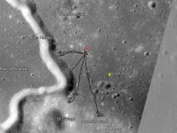
Hadley is one of the easier ones I have found to spot the LMAre you using the add on textures for Hadley? http://absimp.org/orbitersim/apollolandingsites.htmlThis morning I re-did the P63 procedure twice from just before ignition, this time I let the LM do what it wanted and didn't re-designate the landing spot. Both times after landing when I ran V37 N68 I ended up with LAT 026.07 and LON 0036.5, which on a lunar map seems to put me just north of Earthlight Crater. But on my visual I am in Hadley Rille (?). Not sure what is up with that.
No! I didn't know those existed. I'll get that done.Are you using the add on textures for Hadley?
I misspoke, I did run P68 (V37E N68E), and that's the LAT/LON I get.Also you need to run P68, V37 N68 wont call the program.

![Orbiter 2016 [D3D9Client] 12_17_2021 9_40_20 AM.png](https://cdn.orbiter-forum.com/data/attachments/27/27247-4df3de00f7eba87a43c1d33116f467af.jpg?hash=TfPeAPfrqH)